Nanning wastewater treatment plant personnel location management project
Project Background
A comprehensive environmental improvement project in Nanning is a big project of the Nanning municipal government to carry out comprehensive water environment management in the local watershed.
The project is an important initiative to focus on and prevent and resolve the risks in the field of ecological environment, and to solidly promote the ecosystem protection and pollution prevention and control battle.
The project includes river treatment project, pollution treatment project, ecological restoration project, landscape enhancement project, water environment monitoring and information control project. Also included are two new large sewage treatment plants and 13.2 kilometers of laid interceptor network.
At present, the main construction of the downstream sewage treatment plant has been completed.
However, when the pipeline installation operation was carried out, the chief engineer put forward a new demand for a set of BIM technology-based personnel precise positioning system to ensure the safety of construction personnel.
Technical Solution
Combining the comprehensive situation of existing technologies, Nanning wastewater treatment project finally selected stable, reliable and rich in high-precision UWB positioning technology to meet the construction management requirements of the wastewater treatment plant.
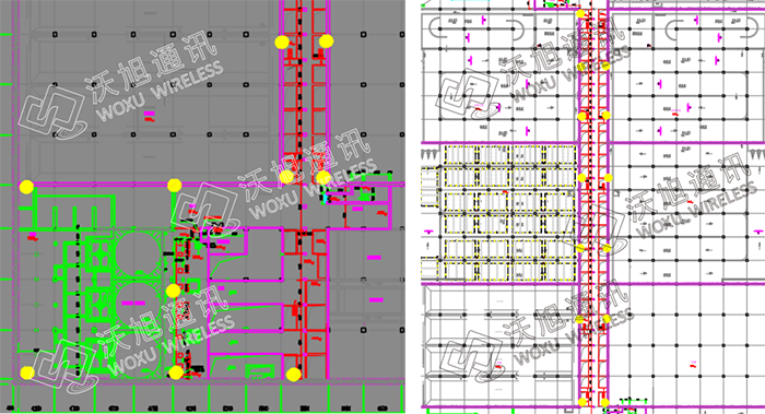
According to the construction characteristics of the site area, Woxu deployed anchors to the construction site, and finally adopted a 2D positioning system for personnel positioning. In this system, personnel need to wear positioning tags to achieve accurate positioning of construction personnel, with a positioning accuracy of 30-50 cm.
At the same time, the positioning system can be combined with BIM model and support secondary development.
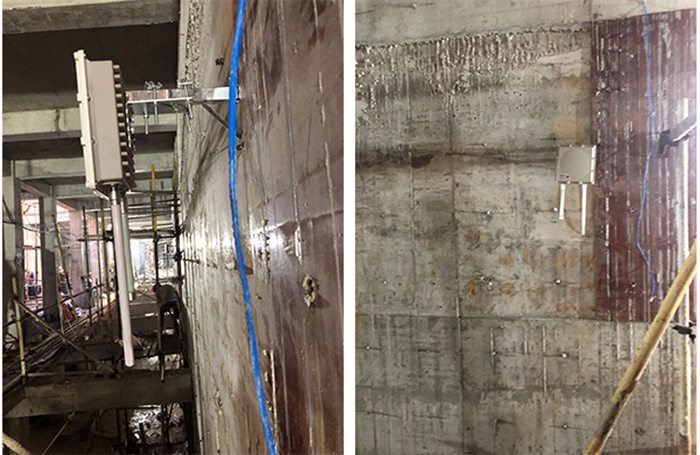
Anchor deployment
Program realization
1) Real-time location display: Build a personnel positioning system based on BIM technology, and display the site personnel, construction area and other information on the map, the map can be scaled and dragged, and also support the switching of multiple maps.
2) Historical monuments: You can query real-time location information and activity trajectory of personnel, and support historical retrieval and replay.
3) Regional alarm: for some dangerous areas, according to the
personnel authority to determine whether to access, detect
illegal entry system timely give an alarm.
For people with permission to detect the stationary area, the
system gives alarm information when the person has not been
active for a long time.
4) SOS alarm: When personnel encounter danger, press the tag with SOS alarm, the alarm information can be sent to the management platform in a timely manner.
5) Send alarm: The system can send a specified reminder to the tag, and the tag can be reminded of the specified mode through the built-in buzzer and vibrator.
6) Low battery reminder: The positioning device has the function of self-detecting battery power, prompting timely charging when the device power is low.
7) Attendance management: based on the characteristics of the system's high-precision positioning, positioning equipment can be added at any location such as the entrance to the site to achieve attendance auxiliary functions, record access to the site records and record time. It can also be used in combination with access control and one-card.
8) Grouping management: The system supports grouping management of personnel, and different groups of personnel have different rights.
Site picture